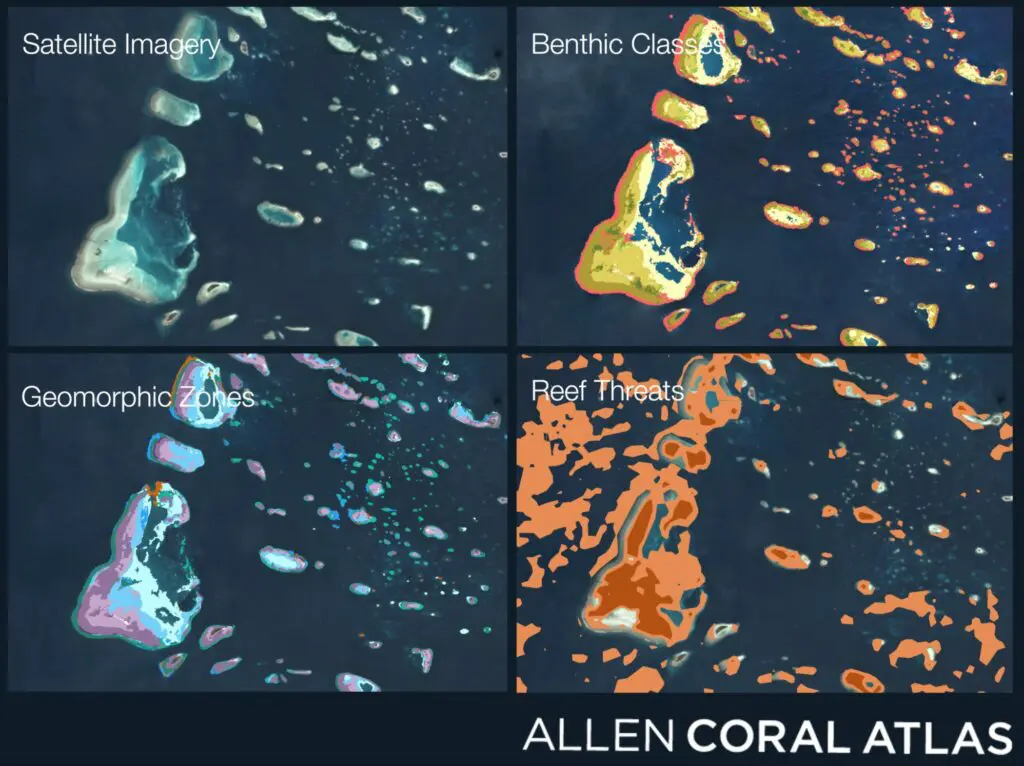
The Allen Coral Atlas is led by Asner Lab to map and monitor the world’s coral reefs using satellites and field programs. Coral reefs are among the most important ecosystems on our planet. A few facts: at least 25% of marine species depend on coral reefs at some point in their life cycle. More than […]
Read More… from Allen Coral Atlas

As our oceans continue to warm and to experience heat waves caused by climate change, it is critically important to understand and continuously update our knowledge on where corals persist. Natural reef ecosystems are the most important and geographically extensive homes for remaining corals, but other places may also harbor corals over the coming decades […]
Read More… from Coral Haven Project
The ʻĀkoʻakoʻa Reef Restoration Program fuses cultural leadership, multi-modal education, advanced science, and government engagement for communities of people and coral in Hawaiʻi. The 120 mile west coast of Hawaiʻi Island is the largest contiguous coral reef in the Hawaiian Archipelago, harboring a diversity of communities, from native Hawaiian villages to new subdivisions, and from […]
Read More… from ʻĀkoʻakoʻa Reef Restoration Program
Asner Lab maps numerous countries in the Caribbean for conservation planning and management in partnership with The Nature Conservancy in the Caribbean, Planet, and Vulcan Inc. Our lab has produced high-resolution maps of important shallow underwater habitats throughout the entire Caribbean—including all shallow-water coral reefs. For the first time ever, countries and territories now have […]
Read More… from Caribbean Reef Conservation
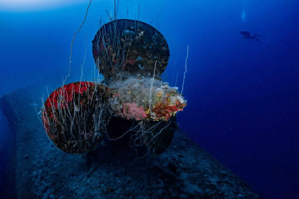
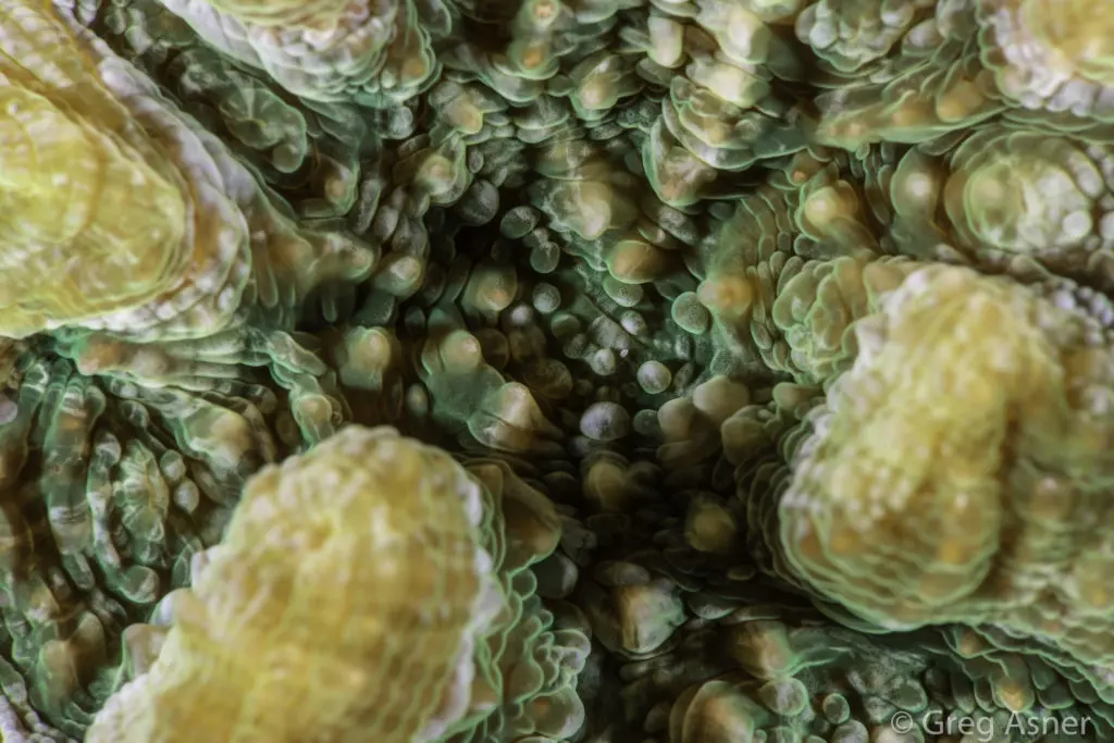
CoralSpec, which is short for Coral Spectranomics, is a project to develop a spectral and chemical library of the critical, habitat-forming coral species of our planet. This project aims to visit as many coral reefs as possible to collect field-based spectral measurements and samples for subsequent chemical analyses in our laboratory. This global field program […]
Read More… from CoralSpec Program
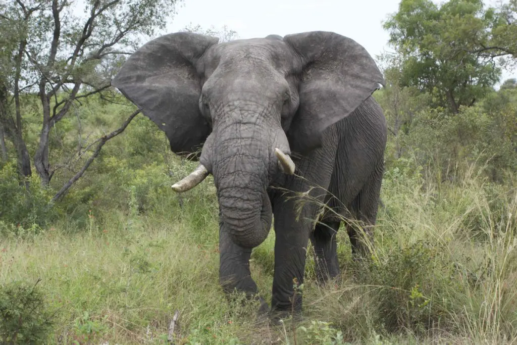
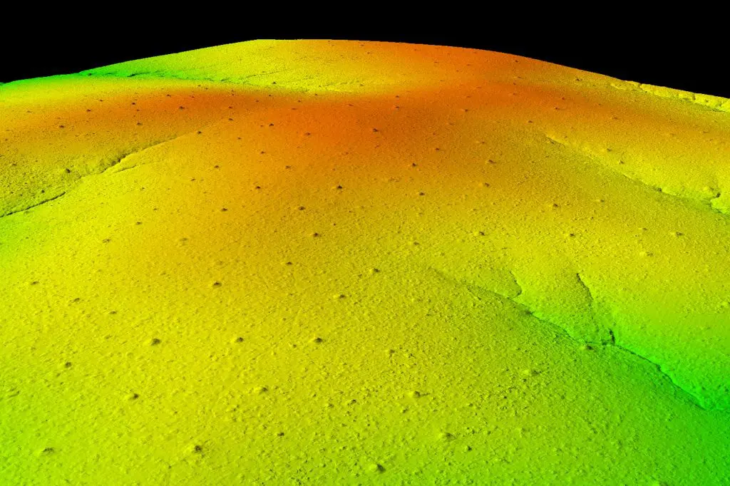
Savannas cover at least 40 percent of the global tropics and support a fifth of the world’s population, thus efforts to better understand biodiversity and ecosystem functioning in these systems are essential for climate change mitigation and effective policy formulation. Using our Global Airborne Observatory’s light detection and ranging (LiDAR) technology, the diverse scope of […]
Read More… from African Savanna Biodiversity
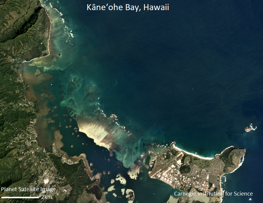
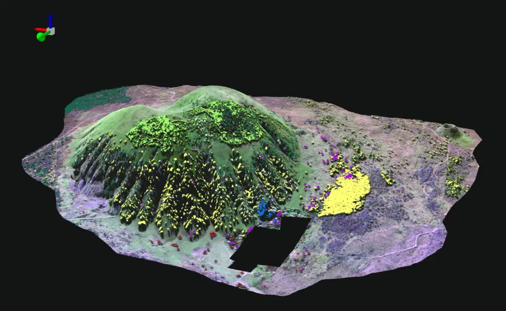
Land use practices over the last century have drastically altered the extent and composition of native Hawaiian forests. One of the exciting projects the Pacific Ridge-to-Reef team at Arizona State University is actively working on is mapping expansive areas of critically important forests at the species level throughout the Hawaiian Islands. These species maps help […]
Read More… from Mapping Hawaii for Biodiversity Conservation

Forests are the lungs of the Earth: they take in and store carbon dioxide and release the oxygen we breathe. This is something we intuitively understand, but we have not yet developed practical and cost-effective ways of accounting for this value in our economic decisions and transactions. The result is that tropical countries are incentivized […]
Read More… from Global Forest Carbon Monitoring
Understanding ecological systems at a global or regional scale is a complex problem, requiring the integration of a wide variety of different sources and types of data. Asner Lab uses an array of approaches to address this challenge, many of which enhance human-scale analyses with machine intelligence. Guided by project-specific experts, artificial intelligence (A.I.) allows […]
Read More… from A.I.
Mapping the biodiversity and functioning of forests and coral reefs is critical to understanding how best to conserve and manage them in a changing world. Advanced Global Airborne Observatory (GAO) mapping technology has reached performance levels required for operational monitoring of forest and reef biodiversity and functional properties from the air. However, spectral-chemical libraries are […]
Read More… from Spectranomics