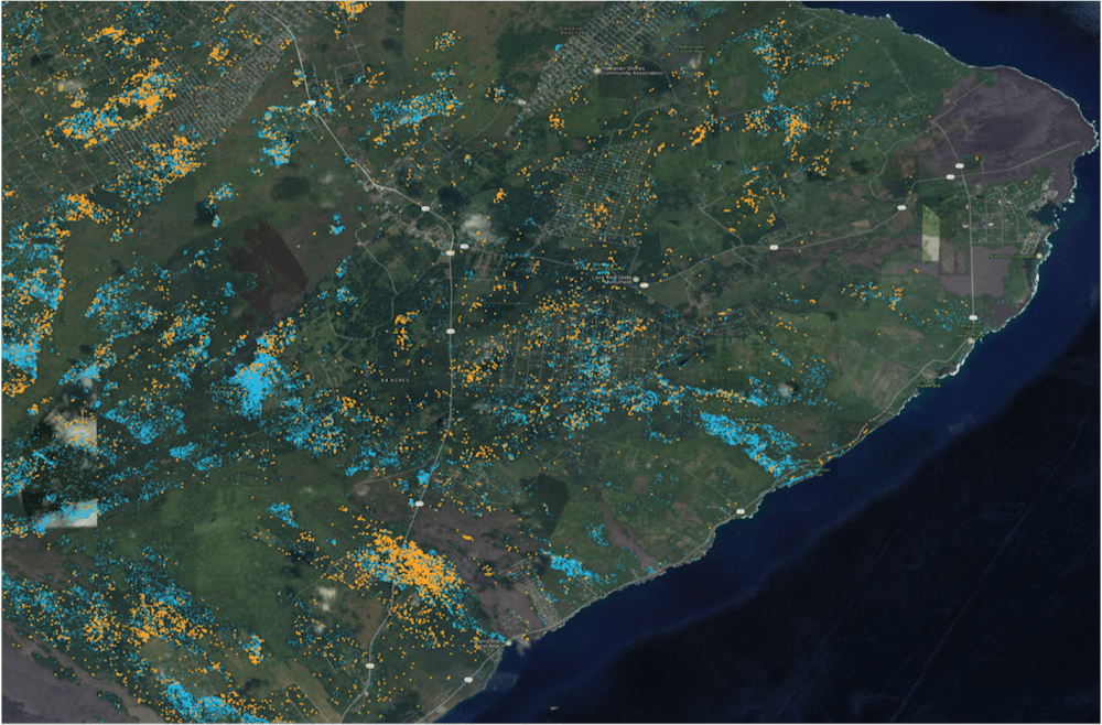
Land use practices over the last century have drastically altered the extent and composition of native Hawaiian forests. One of the exciting projects the Pacific Ridge-to-Reef team at Arizona State University is actively working on is mapping expansive areas of critically important forests at the species level throughout the Hawaiian Islands. These species maps help […]
Read More… from Mapping Hawaii for Biodiversity Conservation

Forests are the lungs of the Earth: they take in and store carbon dioxide and release the oxygen we breathe. This is something we intuitively understand, but we have not yet developed practical and cost-effective ways of accounting for this value in our economic decisions and transactions. The result is that tropical countries are incentivized […]
Read More… from Global Forest Carbon Monitoring

Understanding ecological systems at a global or regional scale is a complex problem, requiring the integration of a wide variety of different sources and types of data. Asner Lab uses an array of approaches to address this challenge, many of which enhance human-scale analyses with machine intelligence. Guided by project-specific experts, artificial intelligence (A.I.) allows […]
Read More… from A.I.
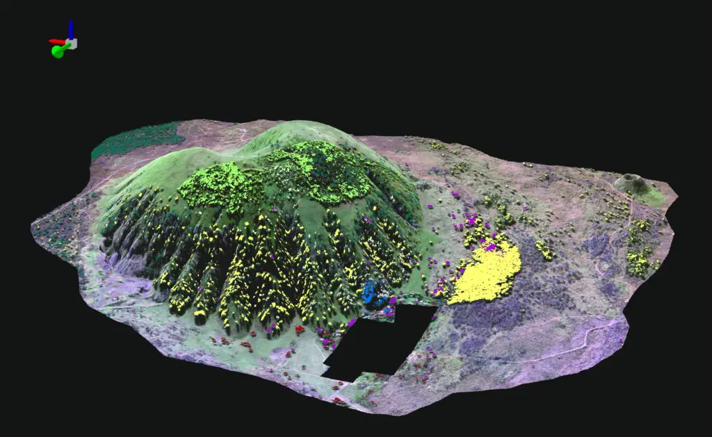
Mapping the biodiversity and functioning of forests and coral reefs is critical to understanding how best to conserve and manage them in a changing world. Advanced Global Airborne Observatory (GAO) mapping technology has reached performance levels required for operational monitoring of forest and reef biodiversity and functional properties from the air. However, spectral-chemical libraries are […]
Read More… from Spectranomics
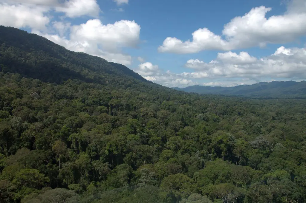
In 2016, the Global Airborne Observatory mapped much of the Malaysian state of Sabah on the island of Borneo in support of a government-led initiative to establish a large new protected area. This work positioned Asner Lab as a key expert in service to the Malaysian government. Our lab is responsible for identifying the most […]
Read More… from New Rainforest Protections in Borneo
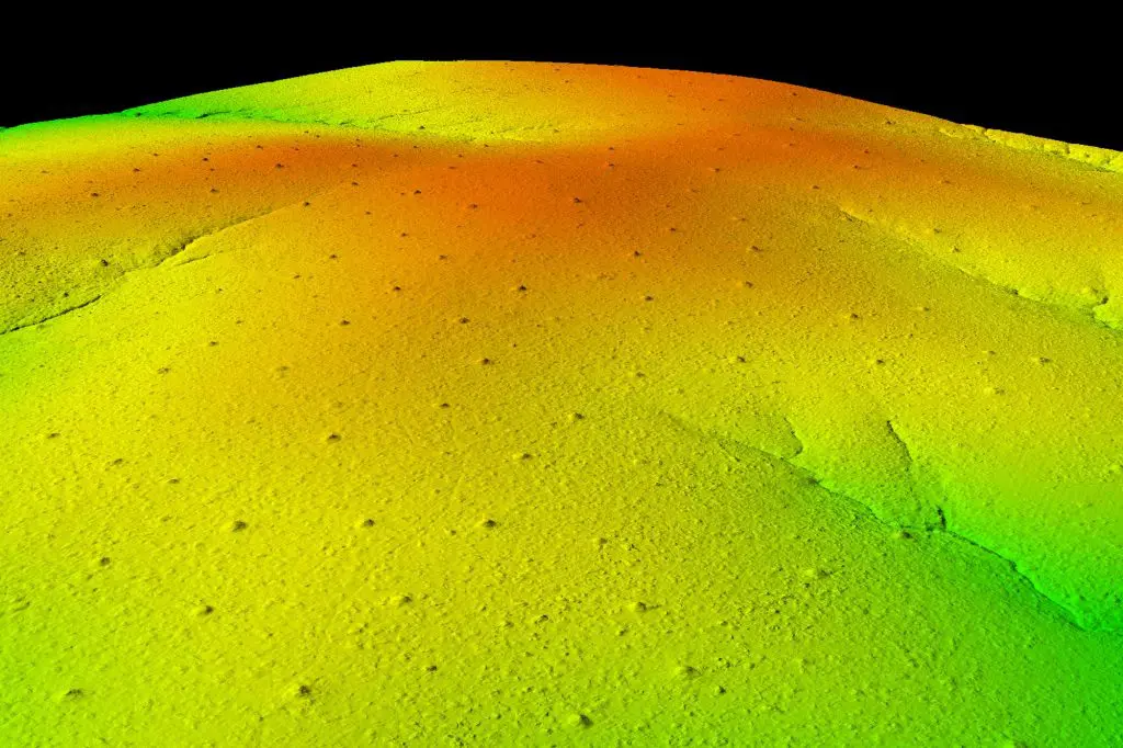
The Global Airborne Observatory (GAO) is mapping forest conditions throughout the Hawaiian Islands, with a special focus on the detection of Metrosideros polymorpha, (also known as Ohi’a), Hawaii’s most important native tree species. The spread of Rapid Ohi’a Death, or ROD, to Ohi’a trees has increased over the years due to a highly aggressive foreign […]
Read More… from Conservation Management of Hawaiian Forests
The Global Airborne Observatory (GAO), formerly the Carnegie Airborne Observatory (CAO), is an airborne laboratory developed by Dr. Greg Asner and his team that houses advanced Earth mapping technology. The GAO’s mission is to make scientific discoveries, support conservation, and galvanize action to protect the environment at large geographic scales. Now in its third generation, […]
Read More… from Global Airborne Observatory