
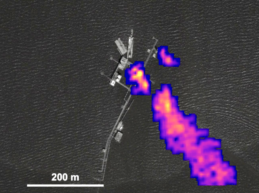
Carbon Mapper
Methane (CH4) and carbon dioxide (CO2) are the two dominant anthropogenic (human-generated) climate-forcing agents. Additionally, CH4 is relevant to air-quality science and applications: CH4 is a precursor for tropospheric ozone and is strongly linked with co-emitted reactive trace gases that can impact human health. Carbon Mapper is designed to detect at least 80% of high emission CH4 and CO2 point sources […]
Learn more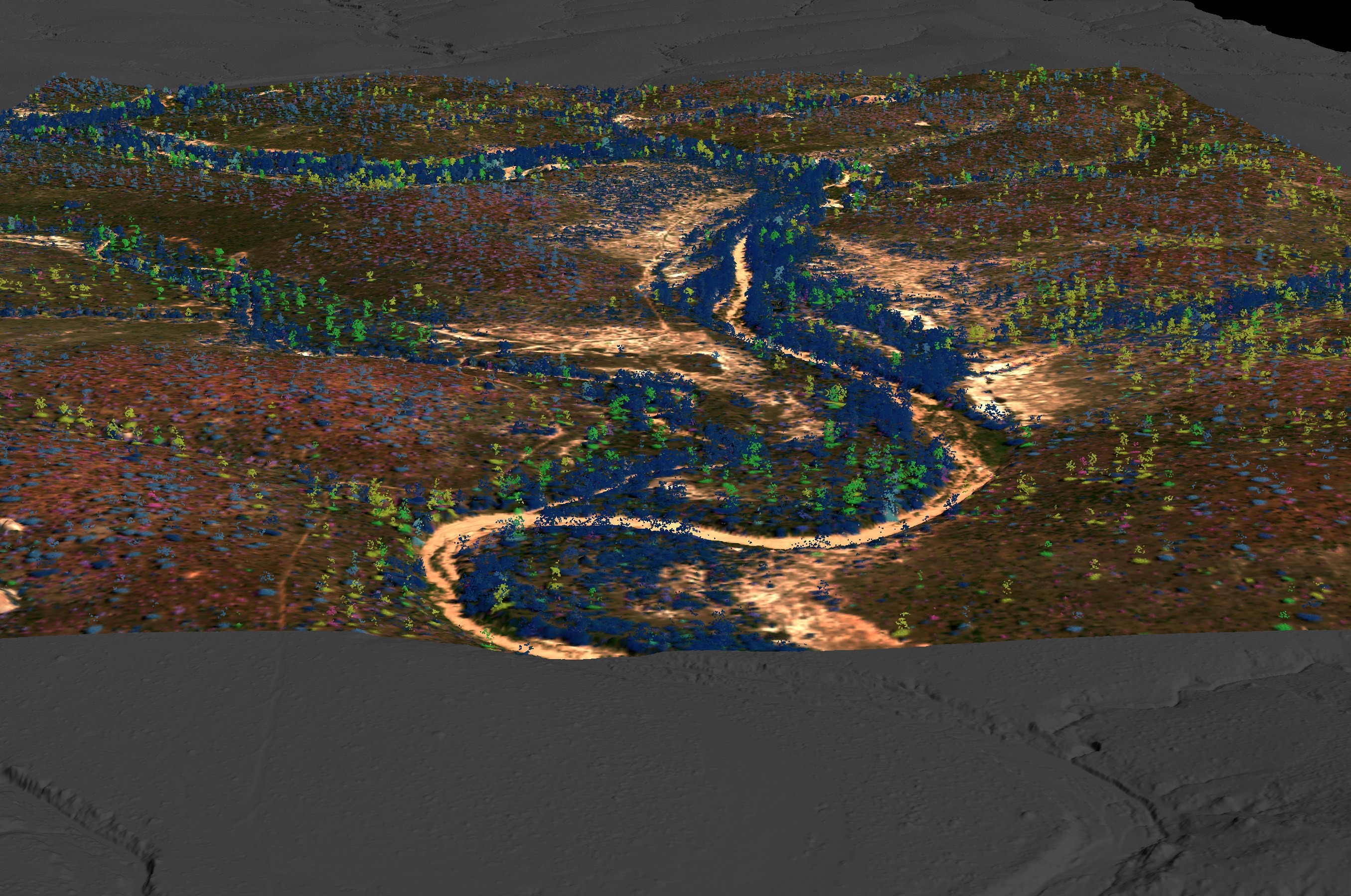
African Savanna Biodiversity
Savannas cover at least 40 percent of the global tropics and support a fifth of the world’s population, thus efforts to better understand biodiversity and ecosystem functioning in these systems are essential for climate change mitigation and effective policy formulation. Using our Global Airborne Observatory’s light detection and ranging (LiDAR) technology, the diverse scope of […]
Read More… from African Savanna Biodiversity
Learn more
Mapping Hawaii for Biodiversity Conservation
Land use practices over the last century have drastically altered the extent and composition of native Hawaiian forests. One of the exciting projects the Pacific Ridge-to-Reef team at Arizona State University is actively working on is mapping expansive areas of critically important forests at the species level throughout the Hawaiian Islands. These species maps help […]
Read More… from Mapping Hawaii for Biodiversity Conservation
Learn more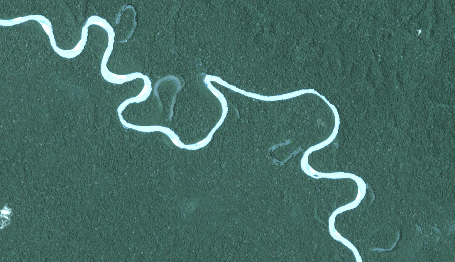
Global Forest Carbon Monitoring
Forests are the lungs of the Earth: they take in and store carbon dioxide and release the oxygen we breathe. This is something we intuitively understand, but we have not yet developed practical and cost-effective ways of accounting for this value in our economic decisions and transactions. The result is that tropical countries are incentivized […]
Read More… from Global Forest Carbon Monitoring
Learn more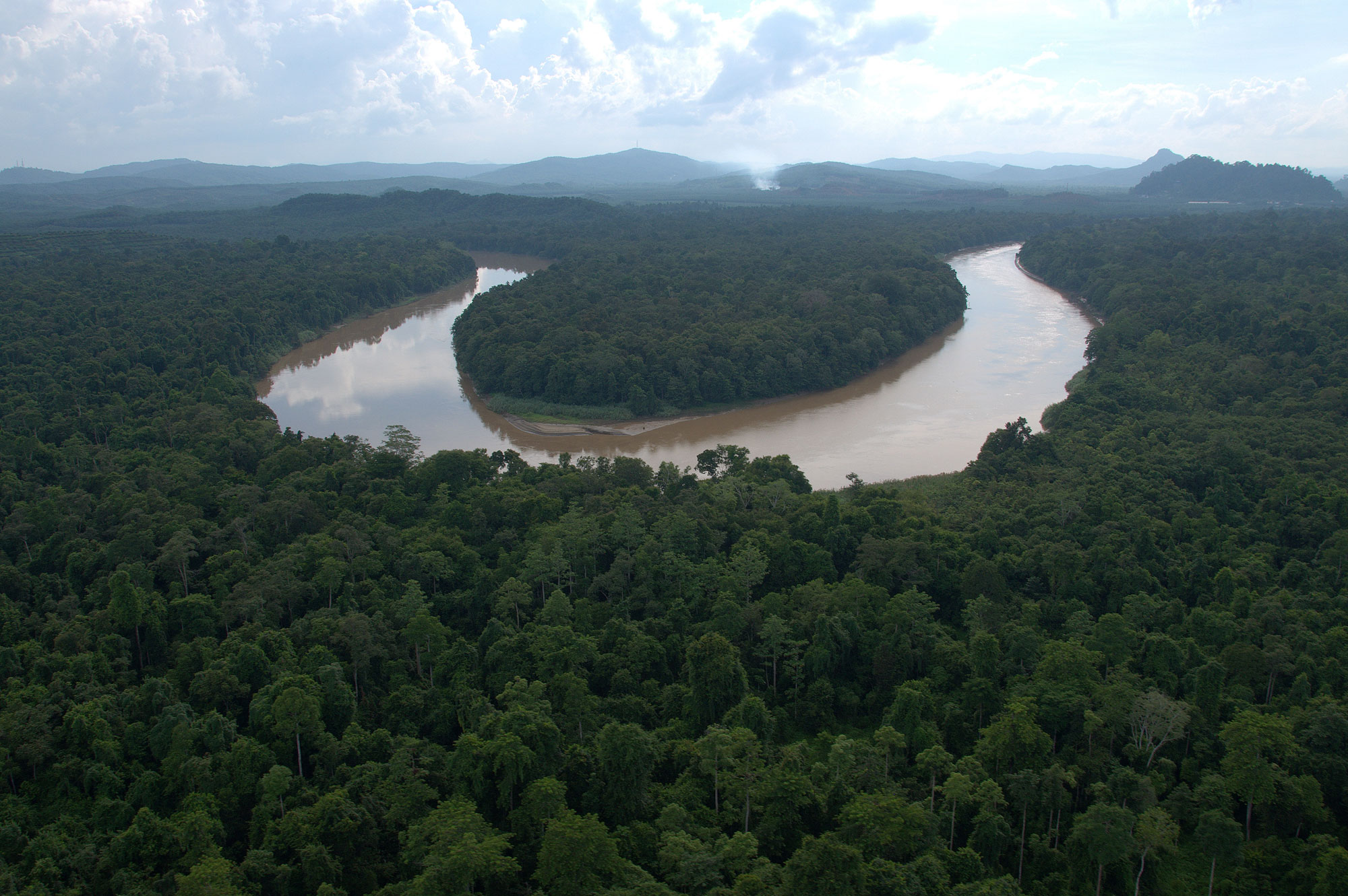
New Rainforest Protections in Borneo
In 2016, the Global Airborne Observatory mapped much of the Malaysian state of Sabah on the island of Borneo in support of a government-led initiative to establish a large new protected area. This work positioned Asner Lab as a key expert in service to the Malaysian government. Our lab is responsible for identifying the most […]
Read More… from New Rainforest Protections in Borneo
Learn more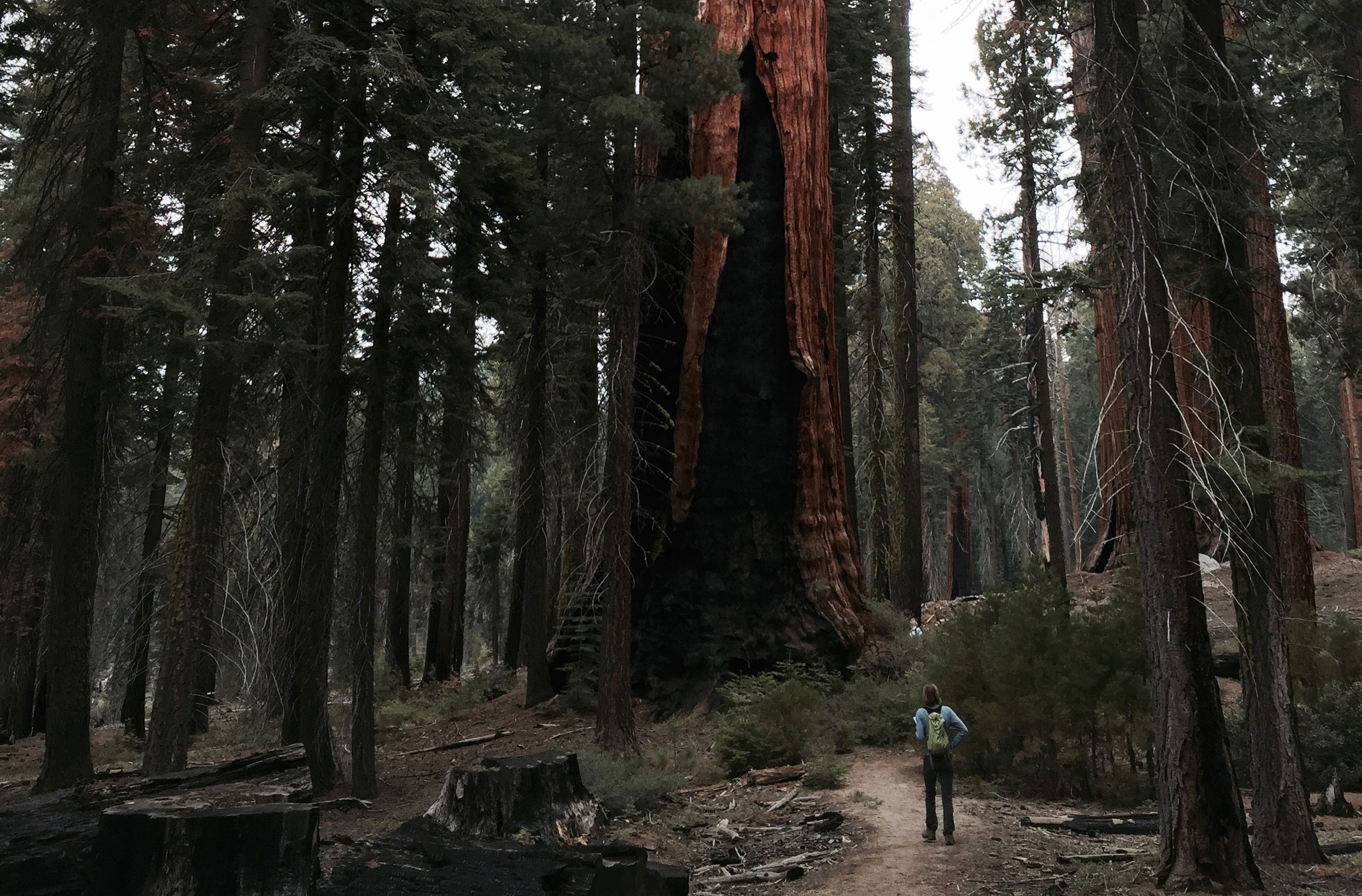
Biodiversity and Carbon Storage in California
California is both a global biodiversity hotspot and home to forest ecosystems with the highest aboveground carbon storage per unit of land area on earth. Warming temperatures and changing precipitation patterns threaten California’s forests and their ecosystem services. Asner Lab is working to map patterns of forest species composition, forest functional diversity, and carbon stocks […]
Read More… from Biodiversity and Carbon Storage in California
Learn more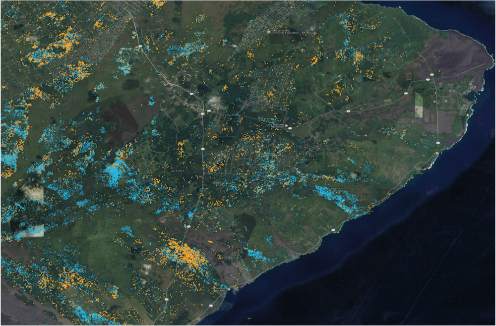
Conservation Management of Hawaiian Forests
The Global Airborne Observatory (GAO) is mapping forest conditions throughout the Hawaiian Islands, with a special focus on the detection of Metrosideros polymorpha, (also known as Ohi’a), Hawaii’s most important native tree species. The spread of Rapid Ohi’a Death, or ROD, to Ohi’a trees has increased over the years due to a highly aggressive foreign […]
Read More… from Conservation Management of Hawaiian Forests
Learn more